Description
- Model:
ADMT-200AX-16D,
- Features:
Wired connection to electromagnetic probes or Bluetooth connection to the Golden Band electromagnetic probe; 10.1″ Android touch screen for real-time imaging.
Automatic imaging.The 10.1″ Android touch screen is intelligent in real time into 2D, 3D and curved images.
Precise and stable.The disadvantages of natural electromagnetic field sources, which are inconsistent in size and change from time to time, are solved and the accuracy is greatly improved.
Triple screen interoperability.The instrument screen, mobile phone screen and computer screen are interoperable.
Intelligent and flexible.1-14 channels are available and an optional electromagnetic probe is available for TT probe measurement mode, which also supports wireless connection to the Aidoo Golden Band.


The 16-channel high-density MT electromagnetic method instrument is a real-time imaging intelligent physical probe jointly developed with the Guilin Institute of Technology Hydrogeological Survey. 16 channels of simultaneous input measurements are used to obtain a stable field source, which not only solves the problem of the natural electric field changing at any time, but also avoids the errors caused by moving the electrodes several times in the same profile and solves the shortcomings of single-channel instruments with different repeated measurement data profiles.
The 16-channel high-density MT electrometer is equipped with a 10.1″ Android touch screen for real-time imaging as standard, and the instrument screen, mobile phone screen and computer screen are interoperable. 1-14 measurement channels are available, as well as optional wireless probes or Aidoo Golden Band, which can switch between MN electrode and TT probe measurement modes, making field operation very convenient and widely recognised by customers.
It has been listed to obtain several invention patents (Patent No. ZL201310205318.9, ZL201110454869.X, ZL201320054153.5, ZL201320303919.9) and has been recognized as a high-tech achievement transformation project in Shanghai.
Main uses:It is widely used for detailed and census exploration of all kinds of metallic and non-metallic ores, for detailed and census exploration of groundwater search, for environmental protection investigation, power design, engineering exploration, geothermal exploration, exploration of coal mining void areas, geological disaster investigation, etc.
49 Years Research and Development
Stable Accurate

Free upgrading at the original price after purchasing within six months
ADMT series products use the earth’s natural electromagnetic field as the working field source to study the electrical structure inside the earth. According to the principle that electromagnetic waves of different frequencies have different skin depths in the conductive medium, the earth’s electromagnetic response sequence from high frequency to low frequency is measured on the surface of the earth. , to study the difference in electrical changes of underground geological bodies at different depths, and to determine the occurrence state of underground geological bodies
Since the development of the short-wire D75 electrical method in 1973, we have been working hard. This high-density MT geophysical probe uses 16-channel simultaneous input measurement to obtain a stable field source, solves the problem of natural electric field changes at any time, and solves repeated measurement data. The shortcomings of different profiles, combined with light and efficient, precise and intelligent and advanced Internet of Things technology, are well received by new and old users.


Real-time
Imaging

Accurate
& Stable

Multi-screen
InterComm

Simultaneous
Measurement
MEET YOUR VARIOUS NEEDS
 Engineering Investigation
 Mineral Exploration
 Water Source Survey
 Environmental Census
Engineering Investigation: Underground cavity, coal mine goaf, dyke piping leak detection, engineering geophysical prospecting, etc.
Mineral Exploration: Exploration for metallic and non-metallic minerals, geothermal hot springs, etc.
Water Source Survey: Exploration for groundwater resources, geological structure stratification, etc
Environmental Census: Environmental protection surveys, leak detection of waste landfills, geological disaster surveys, etc
CUSTOMER USE EFFECT

Burma Maoqi open-pit mining exploration

Instrument: using a high-density MT electrometer
The gold deposit is located in Maoqi, Myanmar. The gold deposit in this area belongs to the quartz vein type gold deposit. The quartz vein generally shows a red high resistivity reaction on the survey map. The red high-resistance area on the survey map is intermittent, and the actual situation of the gold ore veins in this area is also not continuous. One section is good and the other is not good. The gold veins reflected by the measurement profile are the same as the actual mining rules.
SEVEN ADVANTAGES
TO HELP YOU EXPLORE WORRY-FREE
High precision and strong anti-interference
 The core module of the instrument adopts an integrated package, with high precision and greatly enhanced anti-interference.
Equipped with a high-performance processor to run a variety of algorithms, the output is stable and accurate, ensuring the accuracy of the instrument in various environments.
Automatic drawing
 After the measurement is completed, a 2D, 3D color map and a variety of curve graphs will be generated.
Simple operation with 10.1-inch touch screen.
Learn to operate in 5 minutes.
Depth adjustable, intelligent and flexible
 Each product has a variety of adjustable depths, the number of channels can be set.
The two measurement modes of MN and TT can be switched, which is very intelligent and flexible.
Multi-screen data sharing
 Mobile phone, instrument, computer, remote terminal data sharing, only need to log in with the same account.
And support data sharing between multiple accounts.
Free upgrade, value-added purchase
 The instrument includes a full set of APP software to support online free upgrades.
And since the purchase of 6 months to maintain the value of other products.
Lifetime technical support
 Data processing and analysis, instrument maintenance online technical guidance and other services are all supported for life.
Patented product
 Obtained multiple invention patents
(Patent No.: ZL201310205318.9, ZL201110454869.X, ZL201320054153.5, ZL201320303919.9)
GOOD AT CORE AND BEAUTIFUL IN SHAPE

① Hi-Fi Signal Conditioning Amplifier Guaranteed signal accuracy
The analog circuit part of the front-end signal conditioning amplifier of the instrument adopts integrated packaging and shielding, which greatly enhances anti-interference, improves the signal input accuracy, and greatly improves the measurement accuracy of the instrument.
② High performance processor Run multiple algorithms
Adopt high-performance processor, run various algorithms, make the output stable and accurate, and ensure the measurement accuracy of the instrument
③ 10.1 inch touch screen operation
Real-time 2D/3D and curved images

① Grip ② Switch ③ Charge ④ Multi-function interface ⑤ 1-16 Channels
Standard configuration

① Cable ② Electrode hammer ③ Electrodes
④ Wired connection probe (optional)
It is suitable for any ground such as cement, rock, ground breaking, etc. It can be measured by a single person.
⑤ Wireless connection golden hoop (optional)
Full wireless mode. It is suitable for any ground such as cement, rock, ground breaking, etc. It can be measured by a single person.
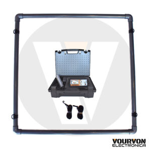
Accessories box specifications

MODELS AND TECHNICAL PARAMETERS
| Model | ADMT-200AX-16D | ADMT-500AX-16D |
|---|---|---|
| Max depth (m) | ≤200 | ≤500 |
| Channel input | 16 channels input simultaneous, electrode distance≤5m | |
| Channel option | 1-14 | |
| Adjustable depth | 60/100/200/300/400/500m | |
| Layer division | 10-100 | |
| Connection | Serial port, WiFi, Bluetooth 4.0, USB | |
| Display | 10.1 -inch, IPS wide Angle, 178° visual touch screen | |
| Operating system | Android6.0.1, RAM 1GB, ROM 8GB (expandable 128GB) | |
| CPU | ARM Cortex-A7, 8-core CPU, 2.0Hz | |
| GPU | OpenGL ES 2.0 | |
| Main function | Depth optional, channel number optional, real-time 2D/3D imaging, battery removable | |
| Measure model | MN/TT | |
| Frequency range (Hz) | 1-8K | |
| Frequency selective | Preset frequency selection and intelligent frequency selection, analog + data filtering, 1-16 times stacking is optional | |
| Resolution | 0.01mV±2% | |
| Sampling time (s) | 60-3600 | |
| Battery | 900mA/H | |
| Weight | 2.8kg | |
SERVING DOZENS OF COUNTRIES AROUND
THE WORLD, WELL RECEIVED BY USERS

PROFESSIONAL TEAM

QUALIFICATION CERTIFICATE
Certificates and Awards: CE, ISO, China National High-tech Enterprise, China National Technical Invention Patent

DEVELOPMENT HISTORY
1973: Developed the domestic short-wire D75 electrical method
1977: Developed an aerial proton magnetometer
1981: Developed domestic resistivity DW83 electrical method
1988: Developed a multi-functional high-power electric method
2001: Developed the NEP series of natural electric field geophysical probes
2005: Completed the “High-Density Electrical Method” project commissioned by the Institute of Geology and Geophysics, Chinese Academy of Sciences
2011: Completed the “Controllable Source Geodetic Electromagnetic Instrument (CSAMT)” project commissioned by the Institute of Geology and Geophysics, Chinese Academy of Sciences
2013: Received the support of the Innovation Fund of the Ministry of Science and Technology, and passed the Shanghai High-tech Achievement Transformation Certification
2017: Developed mobile phone water-finding instrument and geophysical instrument, supporting two-dimensional and three-dimensional automatic mapping of Android system
2018: Independent research and development of 16-channel series products to solve the problem of natural electric field source changes, simple, efficient and precise
2021: Water-finding instrument, geophysical prospecting instrument, aerial geophysical prospecting, earthquake advanced prediction system, etc. will be developed for cloud platform big data automatic analysis function


Two-year
Warranty

Lifetime
After-sales

Professional
Advisors

Free
Upgrade